Maps, Guides & Directions - Getting To Perth County
Maps offered on this website:

Perth County Public Washrooms map
 |
 |
 |
 |
 |
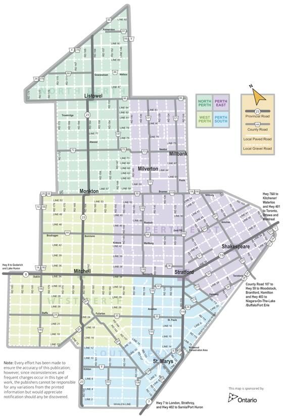
| Perth County Driving map [PDF] |
"Ride the Counties" Perth County Motorcycle Routes [PDF] | Shakespeare to the Shoreline [PDF] |
Perth Arts Connect Member Directory & Map [PDF] |
You will require Acrobat Reader to view and print PDF files. If you do not already
have Acrobat Reader installed, you may download it FREE from Adobe.com.
Driving Directions
From Michigan and Hwy. 402 Cross into Canada at Port Huron/Sarnia and follow Hwy. 402 east to Interchange 65 at Strathroy. Follow Hwy. 81 north for three kilometres (two miles) to County Road 19. Head north to Ailsa Craig, then follow Hwy. 7 east to Stratford.
From Chicago, Detroit and Hwy. 401 Cross into Canada at Detroit/Windsor and follow Hwy. 401 east to Exit 222 (the next exit after Ingersoll), then follow County Road 6 north to Stratford. Lake Erie Ferry crossings In season, a ferry crosses Lake Erie between Sandusky, Ohio, and Leamington, Ontario. For information, call: 1- .
From Buffalo and the QEW Cross into Canada at Buffalo, Fort Erie. Follow the Queen Elizabeth Way (QEW) across Burlington Skyway to Exit 100. Take Hwy. 403 west to the Hwy. 6 exit, and head north towards Guelph. Follow Hwy. 6 to Hwy. 401 at the village of Morriston. Proceed west on Hwy. 401, exiting at Interchange 278 on to Hwy. 8 west at Kitchener. Follow Hwy. 8 west into Kitchener to Hwy. 7/8 west to Stratford.
From Toronto, Ottawa and Montreal Follow Hwy. 401 west to Interchange 278 at Kitchener. Follow Hwy. 8 west through Kitchener, then join Hwy. 7/8 west to Stratford.
Perth County Weather
- See the Stratford 5-Day Forecast on CJCS Radio
- See the current weather for Perth County from accuweather.com
Approximate driving times to Perth County
| Toronto | - 2 hours |
| Ottawa | - 6 hours |
| Buffalo | - 2.5 hours |
| Detroit | - 3 hours |
| Chicago | - 8 hours |
Road Maps
- Maps of Perth County can be found here.
- Official Ontario road maps are available, free of charge, at Provincial Travel Information Centres and in most Visitors’ Information Centres.
- Visit the Ontario Ministry of Transport website for detailed road maps of Southern Ontario.
- Visit Mapquest to get driving instructions from your address to Perth County.
Find out more about re-locating your business to Perth County!
Getting Around Perth County
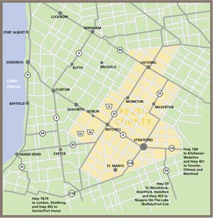
Click on the map to view detailed information about each municipality. CLICK HERE to enlarge the map.

.


