Maps & Guides

Perth County
Public Washrooms map
Let us help you plan the perfect visit.
On foot or bike, by motorcycle or by car – you can just start exploring and we’re sure you’ll be pleasantly surprised. Or you could plan a little using our helpful tools to create your custom itinerary. Love chocolate? Plan yourself a day of touring and sampling! Curious about history? We have all the tools to help you plan a trip into the past. Want to see Perth County by motorcycle? We have maps and tours just for bikers.
-
2016 Visitors Guide and Map
-
REQUEST A GUIDE!
-
Buy Local - Buy Fresh map
-
Perth County Motorcycle Routes
-
Perth Arts Connect Arts & Culture Map
Perth County tourist information can be found at:
- Stratford
Visitors Centre, , across from City Hall
York Street Visitors kiosk - near the Cenotaph - Mitchell
Information center, Lions Park, Ontario Road and Williams St. - Listowel
North Perth Chamber of Commerce office, 580 Main Street W - St. Marys
Visitor Information booth, 5 James St. N
Perth County Accessibility Maps:
- North Perth
- Perth East
- West Perth
- Perth South
- Atwood
- Bornholm
- Dublin
- Listowel
- Mitchell
- Milverton
- Millbank
- Monkton
- Stratford
- St. Marys
- Shakespeare
- Wallace/Gowanstown
- To see communities not listed here, use the search feature on the AXS Website. You may also review and rate businesses based on their accessibility using this map.
Driving Directions
From Michigan and Hwy. 402 Cross into Canada at Port Huron/Sarnia and follow Hwy. 402 east to Interchange 65 at Strathroy. Follow Hwy. 81 north for three kilometres (two miles) to County Road 19. Head north to Ailsa Craig, then follow Hwy. 7 east to Stratford.
From Chicago, Detroit and Hwy. 401 Cross into Canada at Detroit/Windsor and follow Hwy. 401 east to Exit 222 (the next exit after Ingersoll), then follow County Road 6 north to Stratford. Lake Erie Ferry crossings In season, a ferry crosses Lake Erie between Sandusky, Ohio, and Leamington, Ontario. For information, call: 1- .
From Buffalo and the QEW Cross into Canada at Buffalo, Fort Erie. Follow the Queen Elizabeth Way (QEW) across Burlington Skyway to Exit 100. Take Hwy. 403 west to the Hwy. 6 exit, and head north towards Guelph. Follow Hwy. 6 to Hwy. 401 at the village of Morriston. Proceed west on Hwy. 401, exiting at Interchange 278 on to Hwy. 8 west at Kitchener. Follow Hwy. 8 west into Kitchener to Hwy. 7/8 west to Stratford.
From Toronto, Ottawa and Montreal Follow Hwy. 401 west to Interchange 278 at Kitchener. Follow Hwy. 8 west through Kitchener, then join Hwy. 7/8 west to Stratford.
Perth County Weather
- See the Stratford 5-Day Forecast on CJCS Radio
- See the current weather for Perth County from accuweather.com
Approximate driving times to Perth County
| Toronto | - 2 hours |
| Ottawa | - 6 hours |
| Buffalo | - 2.5 hours |
| Detroit | - 3 hours |
| Chicago | - 8 hours |
Road Maps
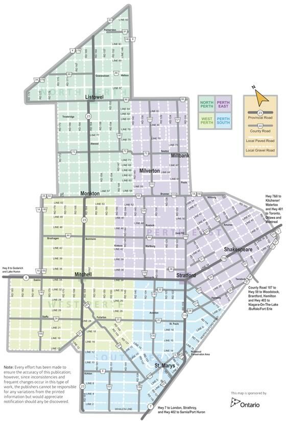
- Maps of Perth County can be found here.
- Official Ontario road maps are available, free of charge, at Provincial Travel Information Centres and in most Visitors’ Information Centres.
- Visit the Ontario Ministry of Transport website for detailed road maps of Southern Ontario.
- Visit Mapquest to get driving instructions from your address to Perth County.
Find out more about re-locating your business to Perth County!
Getting Around Perth County
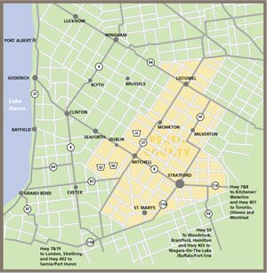
Click on the map to view detailed information about each municipality. CLICK HERE to enlarge the map.


